
Ohio · September 30, 2026
Projects Under Construction by Work Type
This is a real answer State Planner produced from Ohio’s public data.
Start for free to ask your own version of this question, or anything else about your state.
Map every ODOT project under construction in Ohio right now, grouped by type of work: pavement, bridges, safety, bike and pedestrian, and new capacity. Click a project to see its PID, estimated cost and when construction ends.
I’ll include both road-length projects and point locations, grouped by ODOT’s primary work category. I’ll also keep an “Other work” group so projects outside your five categories aren’t omitted. The latest data refresh is September 28, 2026; I’ll check construction dates against September 30.
Ohio projects under construction
Mapped 674 distinct projects at 3,345 locations, with recorded construction dates covering September 30, 2026. Click any line or point to see its PID, estimated total construction cost, and scheduled construction end date.
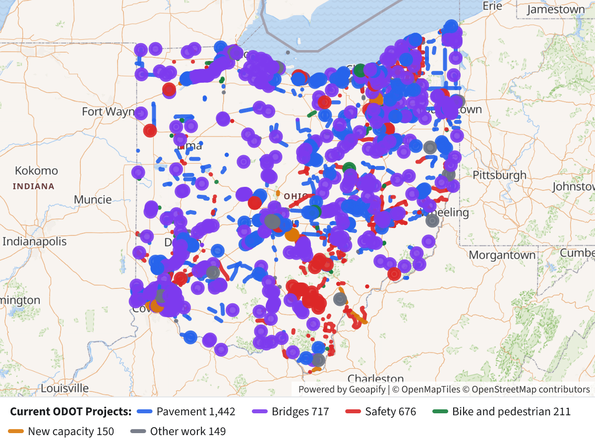 Projects Under Construction by Work Type⬇ Image
Map color / work group Projects Blue — Pavement 224 Purple — Bridges, including culverts and bridge expansion 181 Red — Safety, traffic control and operations 128 Green — Bike and pedestrian 79 Orange — New capacity: added through lanes, new roads and interchange expansion 17 Gray — Other work 45 Projects are grouped by ODOT’s primary work category; a project may include additional types of work. “Other work” keeps facilities, slide repairs, transit and other categories visible rather than omitting them.
Source: ODOT TIMS Current Projects, refreshed September 28, 2026. This includes locally let projects tracked by ODOT. “Under construction” reflects recorded date ranges, not live field verification. A PID can appear at multiple locations; its displayed cost is the whole project’s estimate, not a separate cost for each location.
Layers
- …
- …
- …
- …
- …
- …
- …
Click anything on the map for its details.
The transcript is a Word document with every query the answer ran. Shapefiles of every layer, at full detail, can be downloaded in State Planner: sign up to ask your own question and export any map.