Ohio · October 19, 2026
Franklin County Bridges Over Rivers by Condition
This is a real answer State Planner produced from Ohio’s public data.
Start for free to ask your own version of this question, or anything else about your state.
Show bridges in Franklin county crossing rivers on a map, colored according to their condition.
Franklin County bridges over major waterways, by condition rating
I found 86 bridges in Franklin County that cross a major waterway. "Major" here means streams of Strahler order 4 or higher in the EPA/NHD network, which includes the Scioto, Olentangy, Big Walnut, Big Darby, Alum Creek and Little Walnut. Each bridge is colored by its general appraisal, the lowest of the superstructure, substructure and supplemental ratings on the 0–9 NBI scale.
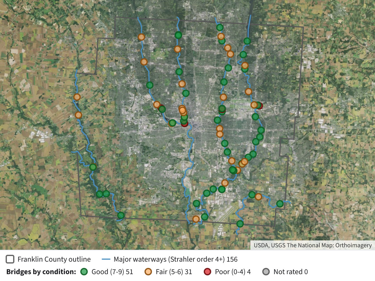 Franklin County Bridges Over Rivers by Condition⬇ Image
Legend
- Green, Good (7–9): 51 bridges
- Orange, Fair (5–6): 31 bridges
- Red, Poor (0–4): 4 bridges
- Grey, Not rated: none in this set
- Blue lines: the major waterways used for the test
- Dark outline: Franklin County boundary
Notes on method
- Crossing test: A bridge counts if its point lies within 40 m of a major waterway line. Bridge points sit on the road centerline, so this allows for the approach and deck geometry. Each bridge's "Feature crossed" field confirms a waterway for most of the 86, such as "BIG WALNUT CREEK" or "SCIOTO RIVER (FISHINGER)".
- Possible false positives: A few entries are highway ramps or interchanges near a river rather than structures over it. Check the "Feature crossed" field before relying on a single bridge.
- Smaller streams excluded: Creeks and ditches below order 4 are not counted, so the total is lower than all bridges over any stream.
- Condition: The General Appraisal is a single inspection rating, not a replacement or funding priority. Records are as ODOT last recorded them.
Layers
- …
- …
- …
- …
- …
- …
- …
Click anything on the map for its details.
The transcript is a Word document with every query the answer ran. Shapefiles of every layer, at full detail, can be downloaded in State Planner: sign up to ask your own question and export any map.